Google Earth

Google Earth

Google Inc.
Version 7.3.4.8642
License
Free
Rating
(32.9K)
Size
58.20 MB
Download
Security Verified
Download
Security Verified
Editor's Choice: Google Earth 7.3.4.8642

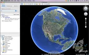
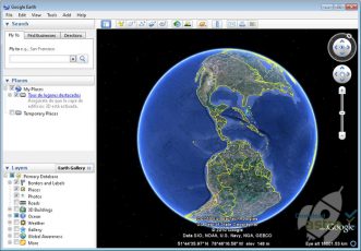
Google’s attempt to map the entirety of Earth presents users with a beautiful view of the blue planet and all of its micro details.

Google Earth is a 3D rendering of the globe that is made possible by millions of photographic images. Satellites orbiting Earth constantly take new photos of areas, which are then added to the rendering database.

As a result, users can zoom in on nearly any location in the world, without ever having to step foot there. Zooming in can take users close enough to see the flowers on their own doorstep, whereas zooming out can show Earth as a total sphere.

However, the service has expanded to offer far more than just global exploration. Users can now add their own photos, or create a project that marks various locations throughout the globe. Projects can then be shared or altered from any device, as they are stored in Google Drive.

Yet, the most impressive feature may be Google’s “I’m feeling lucky” button. Once clicking the button, users are transported to a totally random area of the planet and provided with a boatload of information about that specific place.

All in all, Google Earth does a great job rendering the planet in a 3D model and showing just how fascinating the different areas of the world truly are.

3D rendering application that displays Earth on a macro & micro level.

The sky is anything but the limit with Google Earth.

Google Earth is the mega search engine’s in-house 3D modeling system of planet Earth. But what exactly does it do, and why does it exist?

The answer is simple. Google Earth is designed to provide the most accurate renderings and photo models of the blue planet. It accomplishes this by collecting photos from satellites, and seamlessly merging them together. With the service, users can view the planet in its full entirety, or zoom in enough to see the address on their own home.

As a result, Google Earth can be used for a variety of purposes. Can it be an educational tool to explore photos of foreign capitals and cities? Absolutely. Can it be a map that guides users home after moving to a new city? Definitely. And can it be used as a custom map where users draw lines, drop pins, and add their own photos? Certainly.

The truth is, Google Earth is the revolutionary tool that allows users to explore more of Earth than ever before.

So visit Japan, Australia, South Africa, France, Chile, or anywhere else without ever having to leave home.

FEATURES
● Unlimited Exploration – Explore dozens of different countries, capitals, and natural landscapes with three-dimensional photos and videos. Zoom in to explore the micro details of a city, or zoom out to take in all of the macro details and skylines.

● Custom Projects – Create custom maps and markings to show where you’ve been or where you’re going. Customized projects can be opened from Drive, and loaded onto any device that has the software installed.

● I’m Feeling Lucky – Hop to a random destination anywhere on the globe, while learning about all of its fascinating facts and history. Google utilizes its abundance of information to provide users with an in-depth explanation of thousands of cities and landmarks.

Explore all of the beauty that mother Earth offers with incredible photo renderings from Google.

Google Earth can be accessed from any web browser on PCs, laptops, smartphones, or tablets.

Astro Says:

  • Provides virtual viewing of the world
  • Includes lots of unique information
  • Beautiful views of Mars and the moon
  • Uses a lot of memory
  • Doesn't work with poor internet connections
Google Earth
Google Earth
Google Inc.
Version 7.3.4.8642
License
Free
Rating
(32.9K)
Size
58.20 MB
Download
Security Verified
Comparison of Alternative Programs:
Alternatives to Google Earth - Software Comparison Chart:
App Name
Description
Rating
Downloads
File Size
Action
Learn and analyze geographical information in many formats
911 Downloads
4.00 MB
A mapping program for viewing and editing maps
2.1K Downloads
1,536.00 MB
Views maps in 3D and exchanges data with Google Earth
1.6K Downloads
145.23 MB
Learn about astronomy with this program
736 Downloads
8.62 MB
A system used to take, organize and analyze geographical information.
54.2K Downloads
824.18 MB
TomTom Home software – extra navigation for the directionally challenged
3.8K Downloads
28.00 MB
An interactive digital map
602 Downloads

Add your rating - it takes a second

0
Your Rating
Rating
3.0/5
(32.9K ratings)

Frequently Asked Questions

9 things to know about Google's maps data: Beyond the Map

1. The data on Google maps is pretty accurate in most cases, but it might be incorrect in rural and unpopulated places.

2. If you spot an issue with Google maps, you can report it via the send feedback option.

3. Google meticulously updates its map data every day.

4. Map data is being updated every second of every day by Google employees.

5. If a business or third party has a lot of data to update, they can submit it via the Geo Data Upload tool.

6. Google uses advanced tools such as Dataflow and Cloud Spanner to store and work their maps and machine learning to optimize their data.

7. Google collects map data from satellites, Google cars, third parties, and a multitude of other sources.

8. Google used solar-powered cameras strapped to sheep to capture data on Sheep Island.

9. Googles map images are compiled, put together, and combined to give the most accurate representation of the roads.


Which phones and versions can use the new Google Earth?

The new updates to Google Earth have significantly improved the software in more ways than one but have also changed the minimal specs for running the software in the first place. The minimum Android requirements are 4.1 Jellybean, but Google recommends using at least the 4.4 KitKat to ensure better performance.

If you’re using it on your iOS device, Google Earth should work fine on every device running iOS 6 and over.


How to extract Google Earth high resolution DEM?

Open your Google Earth Pro. Create a path or use the one you already have. Turn on the terrain layer. Go to “Edit” and then “Show Elevation Profile”. Once you’ve done that, you will see the elevation profile, which will display elevation measurements.

You can adjust the measurements in different units per your needs. The next step is to find a screenshot recorder that you can use to capture your high-resolution DEM.


How to download historical Google Earth images?

Find the location you want on the Google Earth desktop version. Go to “view” and then “Historical Imagery” and find the images that were created in the past. If necessary, you can zoom in or out for changing end and start dates that are covered within the desired timeline.

Similarly to any other Google Earth location, you can check different conditions, settings, turn on the sunlight feature, or import GPS tracks for that period when the image was taken. Use a web browser screenshot extension to take photos once you’ve set the right location at the desired period.


Why does some imagery appear to be blurry?

Google Earth does its best to create good quality imagery. Sometimes it happens that you may get a blurry image.

The main reasons causing this can be:
1) The image file is still loading.
2) The image file presently stored has a low resolution.
3) The user is attempting to zoom in on the image too much (a higher zoom level is being used rather than the optimal resolution).